A highland map that works offline
Stikan Map is an Icelandic highland and travel map for phones. The maps are stored on the device, so they work where there is no mobile coverage.
In beta testing · coming to Android, later to iOSAll of Iceland, offline
Maps, place names, search and routing live on the device. Nothing stops working when coverage drops, up on the heath or down in a valley.
Roads and weather on one map
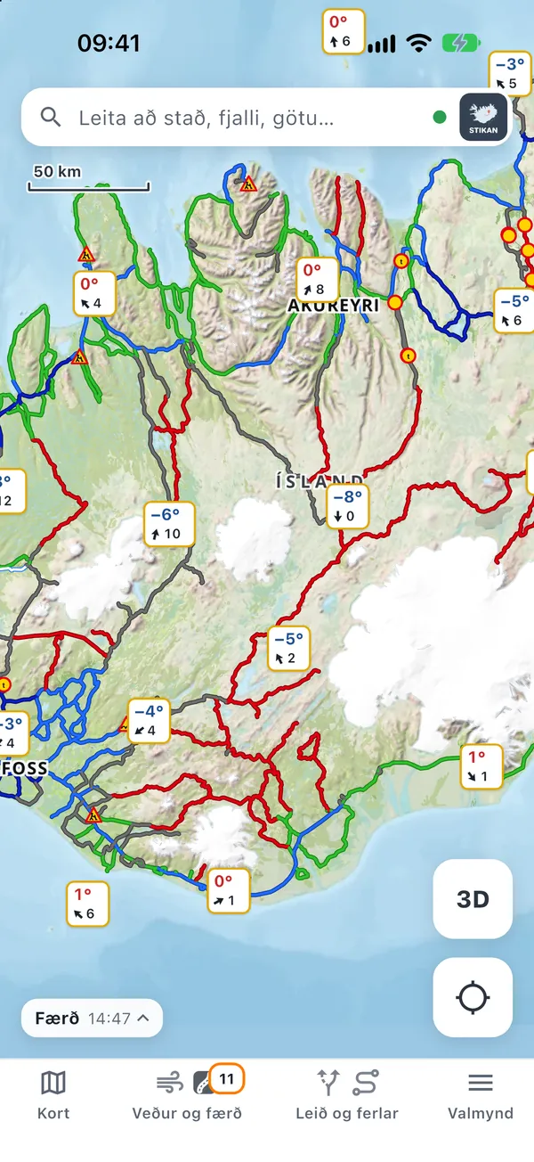
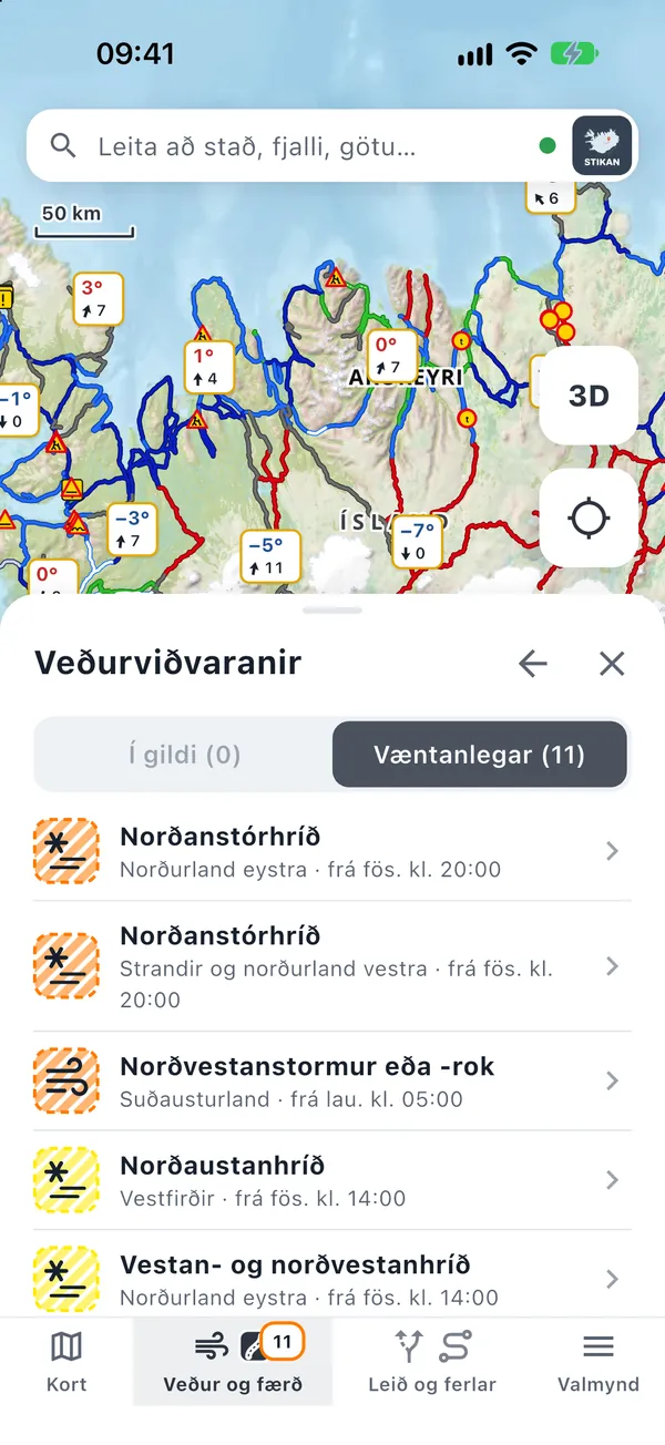
Road conditions from the Road Administration and weather and warnings from the Met Office together on the map. The latest data come with you into the highlands, time-stamped.
Made for the highlands
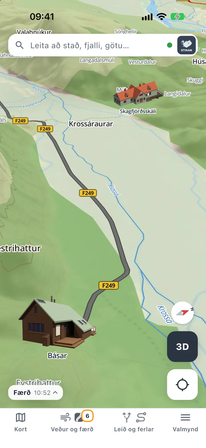
F-roads only if you choose them, fords marked, place names from IS 50V, and huts and terrain in 3D (3D is iOS only for now).
Screenshots
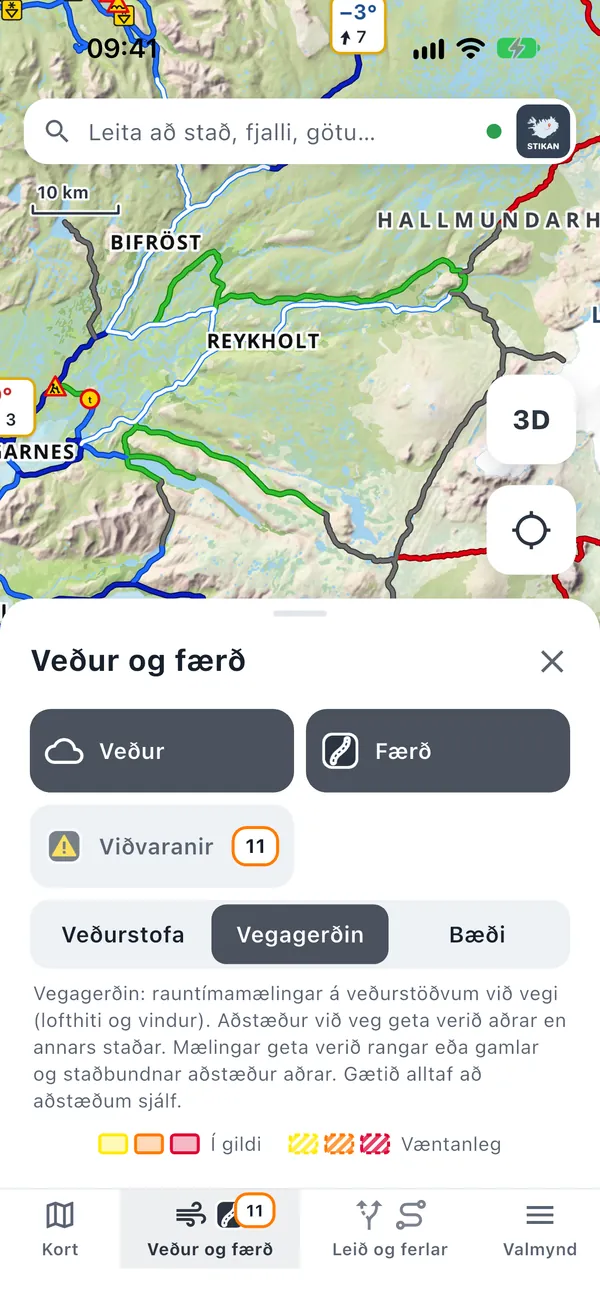
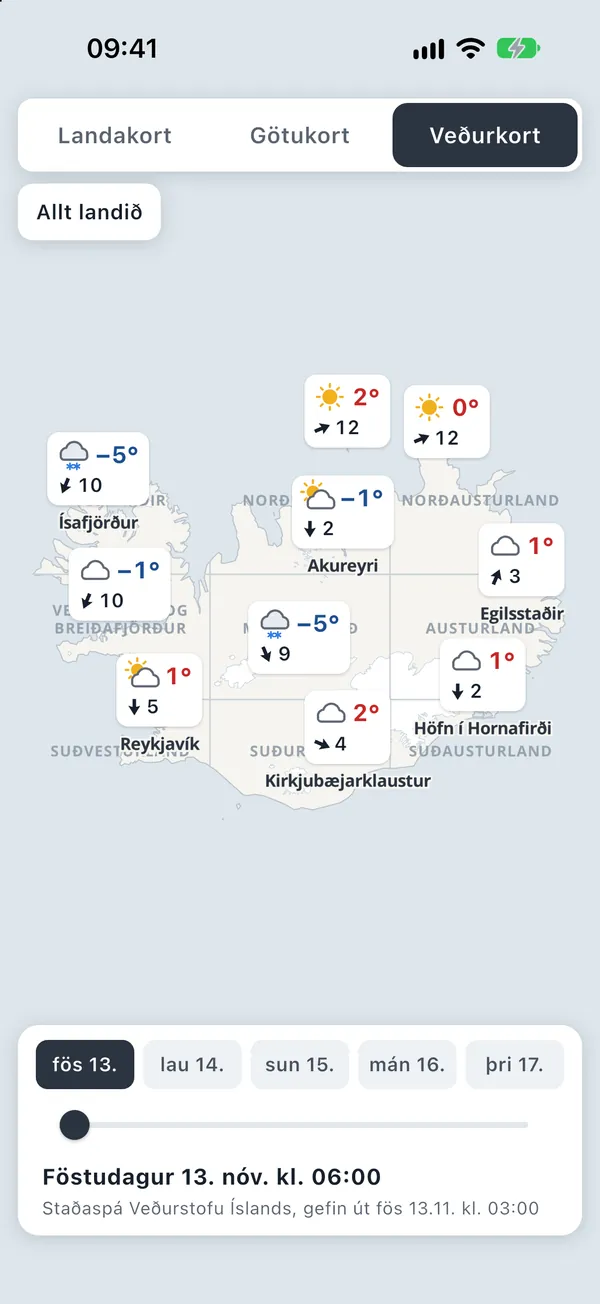
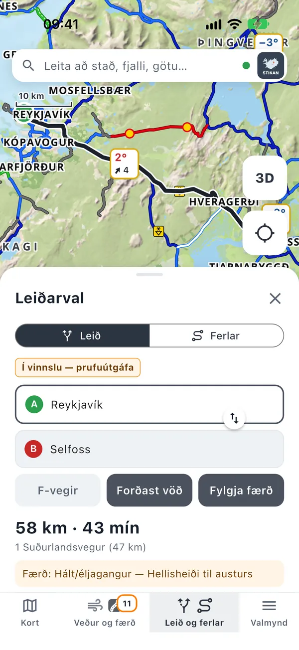
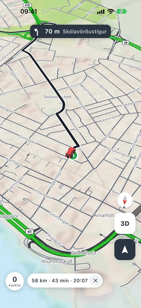
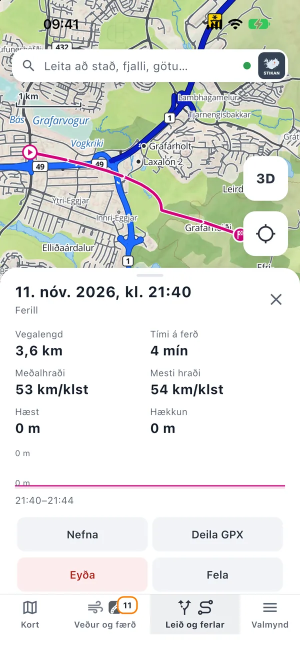
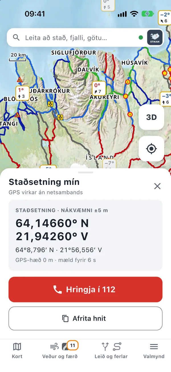
Screenshots from the Icelandic version of the app (beta on iPhone; the app looks the same on Android).
What does the app do?
- Offline mapsA topographic map and a street map on the device, with offline search for place names, towns, streets and huts.
- Place namesPlace names from IS 50V in categories (mountains, valleys, glaciers, lakes and more) that can be switched on and off.
- WeatherObservations from Icelandic Met Office and Road Administration stations, point forecasts and a weather map for the coming days.
- Roads and warningsRoad conditions, roadworks and incidents from the Icelandic Road Administration, and weather warnings from the Met Office.
- Routing and navigationRoutes calculated on the device, F-roads only if you choose them, fords marked. Turns and road conditions ahead along the route (no voice).
- TracksRecord a track while the app is open and share it as a GPX file.
- 3D terrainThree-dimensional terrain from the National Land Survey elevation model (iOS only for now).
- EmergencyYour coordinates in decimal and degrees/minutes, and a button that calls 112.
The latest weather and road data are kept on the device and shown with their time when there is no connection. The app is available in Icelandic and English.
Disclaimer
Stikan Map is not a safety device. The map is for guidance only. Conditions in the highlands change quickly; check road conditions, weather and closures before you set off and keep an eye on conditions yourself along the way.
Glaciers and crevasses: crevasse areas on the map are indicative only and do not guarantee a safe route. Do not go onto a glacier without knowledge, equipment and a guide.
Roads and weather: the data come from the Icelandic Road Administration and the Icelandic Met Office and may be wrong, out of date or miss local conditions. Offline, the app shows the last data it received, with its time.
Fords: river crossings on the map come from OpenStreetMap. Water levels change with weather, season and time of day. Assess every crossing on site.
Routing: routes are calculated from open data and may use closed, impassable or incorrect roads. Always follow signs and closures on site.
Places: locations of huts and campsites come from OpenStreetMap. Check access and permissions before you go.
In an emergency, call 112.
Data sources and licences
- Base map and road network: street map, roads, street names and places © OpenStreetMap contributors (ODbL) · Map style © Protomaps (BSD)
- Geographic data (IS 50V): glaciers, tracks, place names, farms, rivers, lakes, contours and municipal boundaries © Náttúrufræðistofnun (Icelandic Institute of Natural History) / Landmælingar Íslands (National Land Survey of Iceland) (CC BY 4.0)
- Elevation model: ÍslandsDEM © Landmælingar Íslands (CC BY 4.0)
- Land cover: CORINE Land Cover 2024 © European Union, Copernicus Land Monitoring Service
- Weather and warnings: observations, point forecasts and warnings from the Icelandic Met Office (Veðurstofa Íslands, CC BY 4.0). Shown on a map in the app; the Met Office is not responsible for that processing.
- Road conditions and roadside weather © Vegagerðin (Icelandic Road Administration, CC BY 4.0)
Licences: ODbL · CC BY 4.0. Stikan Map is not affiliated with or endorsed by these organisations.
Contact
Questions, bugs or suggestions: himminn@gmail.com
This website uses no cookies, no tracking and no forms.